The workshops will discuss draft updates to the Dearborn County Zoning Ordinance and the Zoning Map.
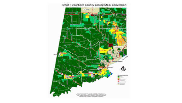
Draft Zoning Map. Photo provided.
(Dearborn County, Ind.) – Two upcoming public workshops will discuss updates to the Dearborn County Zoning Ordinance and the Zoning Map.
The Dearborn County Plan Commission will host the workshops on the following dates:
- Tuesday, July 20 from 12:00-2:00 p.m. at the Lawrenceburg High School Gym, 100 Tiger Blvd, Lawrenceburg, IN 47025.
- Tuesday, July 20 from 6:00-8:00 p.m. at the St. Leon Post 464 American Legion, 28866 Post 464 Road, Brookville, IN 47012.
All citizens and business owners in Dearborn County are invited to attend one or both sessions, and are encouraged to submit written comments by mail to: Department of Planning & Zoning, 165 Mary Street, Lawrenceburg, IN 47025, or by email to planningpublic@dearborncounty.in.gov.
County residents may also complete an online survey that will be made available on or around July 9.
The purpose of the workshops is to identify any questions, issues, concerns, or recommendations regarding the updated draft zoning ordinance text – specifically aimed at the new Agricultural and Residential Zoning Districts.
Last year, the Dearborn County Plan Commission held similar workshops. After seven months of careful consideration and analysis, the Plan Commission and consultant team made several changes to the draft texts to reflect and address the community’s expressed preferences and concerns.
At the same time, the Plan Commission created draft zoning maps to convert the existing zoning map and its 1 Agricultural and 1 Residential Zoning District into the 2 Agricultural and 3 Residential Zoning Districts that are currently being proposed.
The maps take into consideration the current zoning map, the existing land uses identified for all properties in the county for the Comprehensive Plan Update, soils and topography, location of floodplain and flood-prone areas, water and sewer services, environmental constraints, future land use, and more.
For the past four to five months, the draft maps have changed several times, and the number of map alternatives have been narrowed down to two.
As noted last year, the ultimate aim is to create updated zoning ordinance and map that accurately reflects the value of agricultural lands and uses of the county, the housing needs and character of the community, and to allow for more up-to-date tools in the land use and development toolbox
For more information, visit www.dearborncounty.org/planning.
 Arrest Made After Shots Fired Call in Burlington
 Drone Program Launched in Batesville
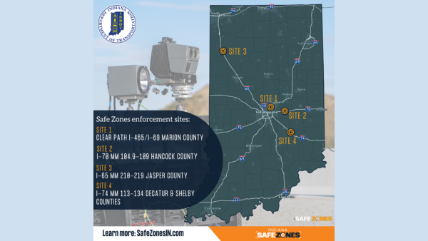 Safe Zones Enforcement to Begin on I-74
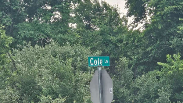 Volunteers Needed for Cole Lane Roadside Clean-up
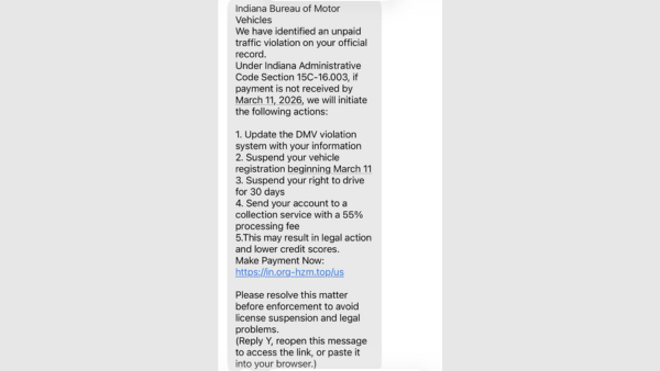 Indiana BMV Warns of Text Scam
 OCCF Community, Junior College Scholarship Applications Available